I don’t know about you, but when Google Earth first launched, I was completely enthralled. Admittedly, my excitement for on-demand satellite imagery has lessened over the years, but at least a small part of that had to do with the nature of the technology. Satellite images were often months or in most cases, years old. Sure, you could zoom in and see your house, work, or other landmarks in your life, but in some cases the landmark wouldn’t be there, you’d see your old car sitting in the driveway, or other discrepancies. Planet is a company that wants to generate satellite images of the entire Earth. That isn’t too impressive on its own, but they plan to refresh their images daily. That is much more interesting.
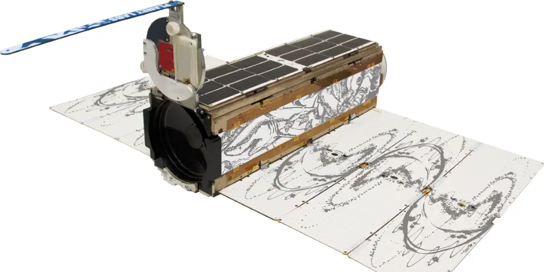
Planet is based in San Fransisco and was founded in 2010 by former NASA scientists. Their current model for coverage, or their constellation, consists of a huge number of small satellites, 88 of which were recently launched into orbit aboard an Indian Space Research Organisation, ISRO rocket. That brings their total number of small satellites to 149, and the company is also in the process of buying seven larger, higher-resolution satellites as part of an acquisition of Terra Bella, a company currently owned by Alphabet.
The huge number of small satellites will allow Planet to image the entire Earth every day. There is also a bit of redundancy built in, as if one or two satellites fail, the system can continue to work. as Planet Chief Executive, Will Marshall told Seeker:
We put the latest technology on and throw it into space. We launch more than we need and if one or two fail it isn’t the end of the world.
With that in mind, Planet intends to launch 48 more satellites into orbit this summer. Planet already has customers lined up, and they currently provide data for a few specific types of customers: agriculture, internet companies for updated consumer maps, and of course, the government.
Their capabilities in agriculture are particularly interesting, and not even all of the government uses are as nefarious as one might initially think:
“We can tell crop yield on a pixel-by-pixel basis for every farm around the world,” Marshall said. The data is being used to precisely manage where and what to grow and when to plant, water, fertilize and harvest crops.
Governments are interested in the images to support services ranging from disaster response to urban planning. Brazil and Mexico buy the data to track deforestation.
What types of applications would you like to see for daily satellite images of the Earth? Tell us what you think in the comment section below, or on Google+, Facebook, or Twitter.
[button link=”http://www.seeker.com/this-company-is-poised-to-generate-satellite-images-of-the-entire-eart-2265856385.html” icon=”fa-external-link” side=”left” target=”blank” color=”285b5e” textcolor=”ffffff”]Source: Seeker[/button]